Home     Blog

Weather Satellite

weather satellite 150x150 Weather Satellite

A weather satellite is a satellite which is used by meteorologists to gather information about the weather.

Weather satellites give meteorologists a view of weather patterns over a very large area. This enables meteorologists to track large weather patterns and make more accurate predictions of future weather behavior.

In addition to visual monitoring, weather satellites may also use thermal imaging, X-ray sensors, high-energy proton detectors, alpha detectors, and energetic particle sensors.

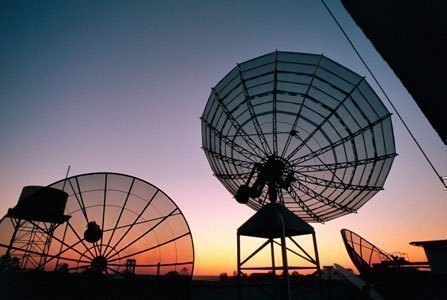
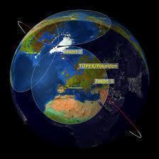
Weather satellites travel in either geostationary or polar orbits.

Weather satellites in geostationary orbits provide views of the same portion of the earths surface 24 hours a day. Weather satellites in polar orbits move across the surface of the earth and are able to provide a view of the entire planet over the course of a 12 hour orbit.

NASA makes weather satellite images from their Geostationary Operational Environmental Satellite (GOES) systems available on the web at the Global Hydrology and Climate Center.

VN:F [1.9.17_1161]
Rating: 5.0/10 (3 votes cast)
Weather Satellite, 5.0 out of 10 based on 3 ratings
Follow Will.Spencer on

Comments (1)


  1. ohimai says:

     Anybody know how Gravitational fields are important to satellites?

    VA:F [1.9.17_1161]
    Rating: 0.0/5 (0 votes cast)

Leave a Reply

Related Posts

  • Free Weather Satellite Images

    Weather satellites are now operated by the United States, Japan, Europe, Russia, India, and China. These weather satellites provide invaluable information to meterologists and climatologists. In addition, individuals all over the globe enjoy these fascinating pictures of the Earth from outer space. Free Weather Satellite Images on the Web The NOAA's Geostationary Satellite Server provides [...]...


  • Polar Orbit

    A polar orbit is an orbit of any object in space, natural or synthetic, that passes around the Earth in a North-to-South direction rather than a West to East direction, which is known as an “equatorial orbit”. Polar orbits are advantageous because they will eventually travel across every possible latitudinal and longitudinal position on the [...]...


  • Inclination

    Inclination is the angle between a satellite orbit and the equator. Inclination is measured as the angle at which the satellite crosses the equator while passing from the southern hemisphere to the northern hemisphere. A satellite travelling in a geostationary obit will have an inclination of zero. Inclination is between 0 and 90 degrees for [...]...


  • Satellite Phone

    A satellite phone is a mobile telephone which communicates using satellites instead of using cell towers. Three major satellite phone networks are currently in operation: Iridium Globalstar Thuraya Iridium The Iridium network uses 66 low earth orbit satellites in polar orbits 485 miles above sea level. The use of low earth orbit satellites helps minimize [...]...


  • Geostationary Satellite

    Geostationary satellites are located exactly above the earth’s equator and revolve around the earth in a circular orbit. Their revolving speed and direction (west to east) are exactly same as that of the earth, which makes it look stationary from the earth’s surface. The exact altitude of these satellites above the equator is approximately 36,000 [...]...